Sunset District, San Francisco
Sunset District covers 0.9 square miles of San Francisco, and about 17,796 people live here. This page maps 27 parks and public places and 2 businesses inside its lines, most of them Groceries and Markets.

Living In Sunset District
Sunset District has about 17,796 people on 0.9 square miles, 20,269 per square mile, denser than San Francisco as a whole (3,582).
The median household earns $137,780 a year, 2% below the city median, #47 of 75 neighborhoods.
64% of homes are owned by the people living in them, and the median rent is $3,119 a month.
It is an older part of town: 89% of homes were built before 1960.
People here skew older, with a median age of 48 against 40 citywide.
89% of homes have broadband internet.
Inside its lines: 10 places of worship, 6 transit stops, 4 schools, 1 clinic and 1 places to eat.
People
Money And Work
Housing
Getting Around
Connected
US Census Bureau American Community Survey 2020 to 2024, added up from the census tracts in Sunset District. Ranks count neighborhoods with 500 or more people.
Parks, Schools And Public Places In Sunset District
Places Of Worship 10
- Episcopal Church of the Incarnation
- Holy Name of Jesus Roman Catholic Church
- Nagara Dhamma Temple3225 Lincoln Way, San Francisco, CA 94122
- San Francisco Chinese Baptist Church
- San Francisco Korean United Methodist Church3030 Judah Street
- San Francisco Mandarin Baptist Church2332 Judah Street
- Sunset Baptist Church
- Sunset Branch Lutheran Church of the Holy Spirit2400 Noriega Street
- Sunset Chinese Baptist Church3638 Lawton Street
- West Portal Lutheran Church & School3101 Moraga Street
Transit Stops 6
- Judah Street & 28th Avenue
- Judah Street & 31st Avenue
- Judah Street & 34th Avenue
- Judah Street & 40th Avenue
- Judah Street & 43rd Avenue
- Judah Street & Sunset Boulevard
Schools 4
- Francis Scott Key Elementary School1530 43rd Avenue, San Francisco, CA 94122
- Holy Name School1560 40th Avenue, San Francisco, CA 94122
- Lawton Alternative Elementary School1570 31st Avenue
- San Francisco Mandarin Baptist Church Chinese School2320 Judah Street
Clinics 1
- Sunset Health Services
Fire Stations 1
- San Francisco Fire Station 181935 32nd Avenue, San Francisco, CA
Parks 1
- Sunset Playground2201 Lawton Street, San Francisco, CA 94122
Playgrounds 1
- Sunset Children’s Play Area2201 Lawton Street, San Francisco, CA 94122
Post Offices 1
- Postal Depot2636 Judah Street
Sports Fields 1
- American Gymnastics Club2520 Judah Street
Trails And Bike Paths 1
- Ortega Street
Places To Go In Sunset District
The most reviewed spots inside these lines, with photos where they have one.
Businesses In Sunset District
Is yours missing or wrong? List or fix it free.
Groceries and Markets 1
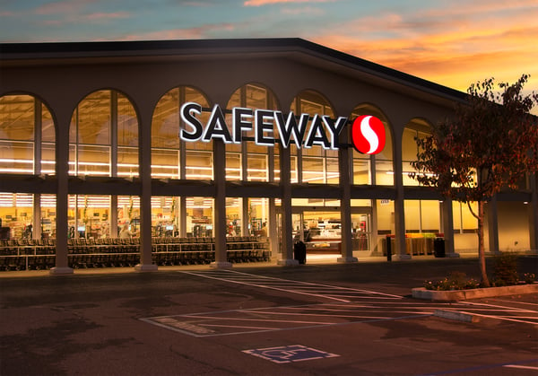 SafewayGrocery store
Food and Drink 1
 Andytown Coffee RoastersCoffee shop
Own A Business In San Francisco
List it free on your neighborhood page in about two minutes. Townstoop is built by Clickflame, building local business sites since 2004.
Sunset District Questions
How many people live in Sunset District
About 17,796, from the Census American Community Survey tracts inside the Sunset District lines.
What parks are in Sunset District
1 mapped, including Sunset Playground.
How many schools are in Sunset District
4 schools are mapped inside the neighborhood.
What is the rent like in Sunset District
The Census median gross rent is $3,119 a month, against $2,476 for all of San Francisco.
Do people rent or own in Sunset District
36% of homes are rented and 64% are owned, against 62% rented across San Francisco.
How do people get to work from Sunset District
The average commute is 33 minutes. 40% drive alone, 17% take transit, 5% walk and 22% work from home.
How old are the homes in Sunset District
89% were built before 1960 and 1% in 2010 or later. 74% are single family homes.
Is Sunset District a family neighborhood
23% of households have children and 14% of residents are under 18. 25% are 65 or older.
Sources, Census figures from the US Census Bureau American Community Survey five year estimates, parks, schools and public places from OpenStreetMap contributors (ODbL). How we build these pages.